Processing Pipeline
The Hydro-Topo Features package implements a comprehensive workflow for extraction of hydro-topographic features from digital elevation data and water feature information.
Pipeline Overview
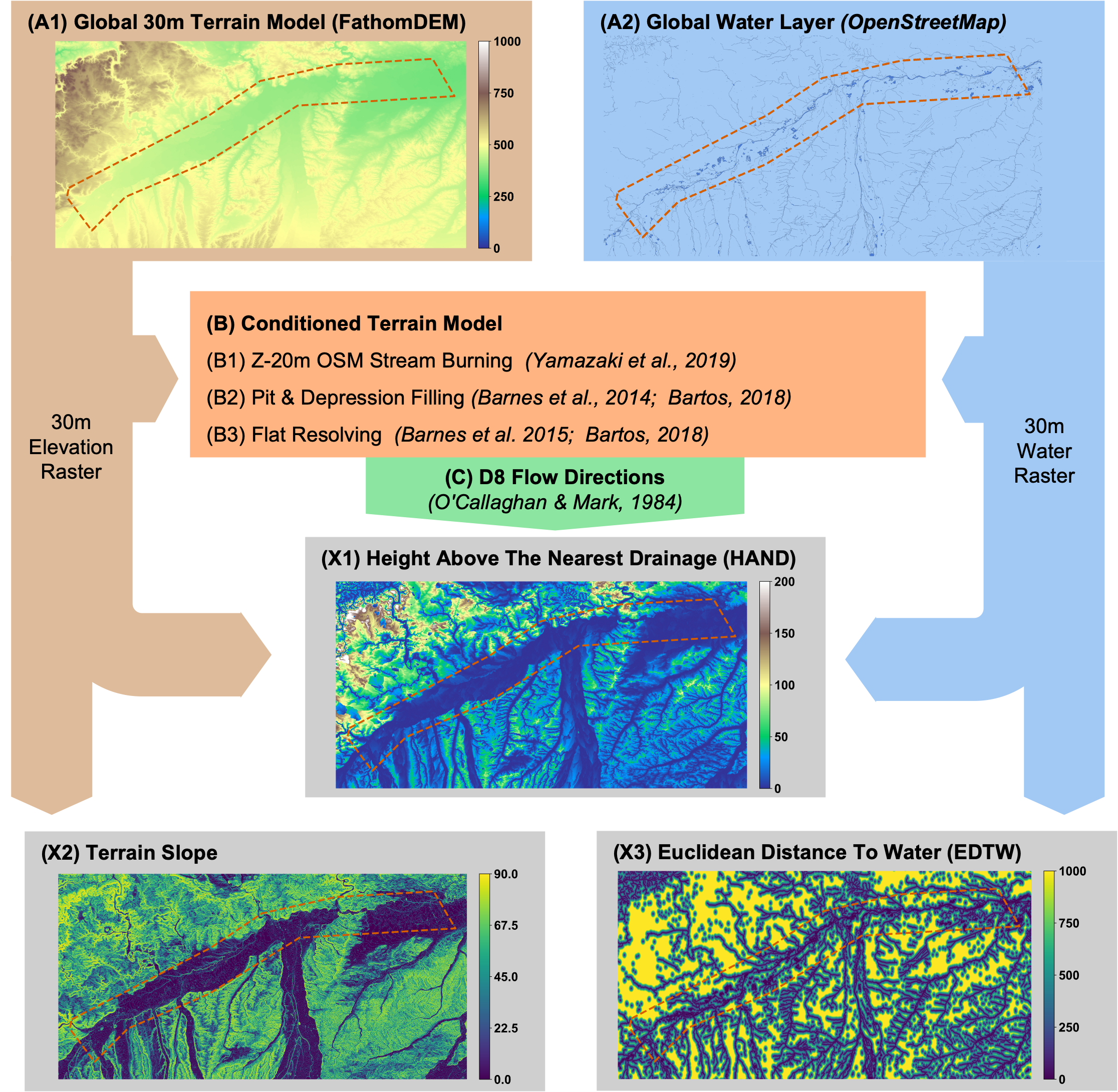
Quasi Global and Automatic Pipeline To Compute the Hydro Topographic Descriptors: (X1) HAND, (X2) Slope and (X3) Euclidean Distance To Water, using (A1) FathomDEM and (A2) OpenStreetMap Water as Input Data. A (B) Conditioned DEM is computed to ensure drainage and an accurate (C) Flow Direction approximation.
The workflow consists of the following main steps:
Data Preparation
Digital Elevation Model (DEM): The process begins with a 30m resolution DEM (e.g., FathomDEM)
OpenStreetMap Water Layer: Water features are extracted from OpenStreetMap data
DEM Conditioning
Stream Burning: Lowering the DEM by 20m along OSM-derived water features
Pit & Depression Filling: Removing depressions that would create artificial sinks
Flat Resolving: Creating artificial drainage gradients in flat areas
Flow Direction Computation
Using the D8 algorithm to determine flow directions from each cell to its steepest downslope neighbor
Feature Extraction
HAND (Height Above Nearest Drainage): Vertical distance to the nearest drainage channel
Terrain Slope: Maximum rate of elevation change in the terrain
EDTW (Euclidean Distance To Water): Straight-line distance to the nearest water body
The generated hydro-topographic features provide critical contextual information for: - Flood susceptibility analysis - Hydrological modeling - Terrain characterization - Water resource management
Running the Pipeline
The entire pipeline can be executed with a single function call:
from hydro_topo_features.pipeline import run_pipeline

outputs = run_pipeline(
    site_id="my_area",
    aoi_path="path/to/area_of_interest.shp",
    dem_tile_folder_path="path/to/dem_tiles/",
    output_path="outputs",
    create_static_maps=True,
    create_interactive_map=True
)
For more details on specific steps, refer to:
DEM Conditioning - Details on the DEM conditioning process
Feature Extraction - Information about feature extraction methods
Visualization - Guidance on visualizing the extracted features